
Blizzards with wind gusts up to 75 mph Tuesday could topple trees and power lines, and bring whiteout conditions that make travel “difficult to near impossible,” the National Weather Service said. Blizzards happen when blowing snow and sustained strong winds combine for at least three hours and reduce visibility to a quarter-mile or less.
“Widespread travel disruptions are likely across the region,” the weather service warned, adding that the storm will continue to impact a large swath of the north-central US through Tuesday.
Parts of Nebraska, South Dakota, Kansas, Colorado and Wyoming are under blizzard warnings Tuesday.
Residents were cautioned to avoid travel, but if they must be on the road, to bring survival kits and stay in their vehicles in case they get stranded.
The storm was hitting parts of the region Monday, and driving conditions were “rapidly deteriorating across the state,” the Nebraska State Department of Transportation said that day.
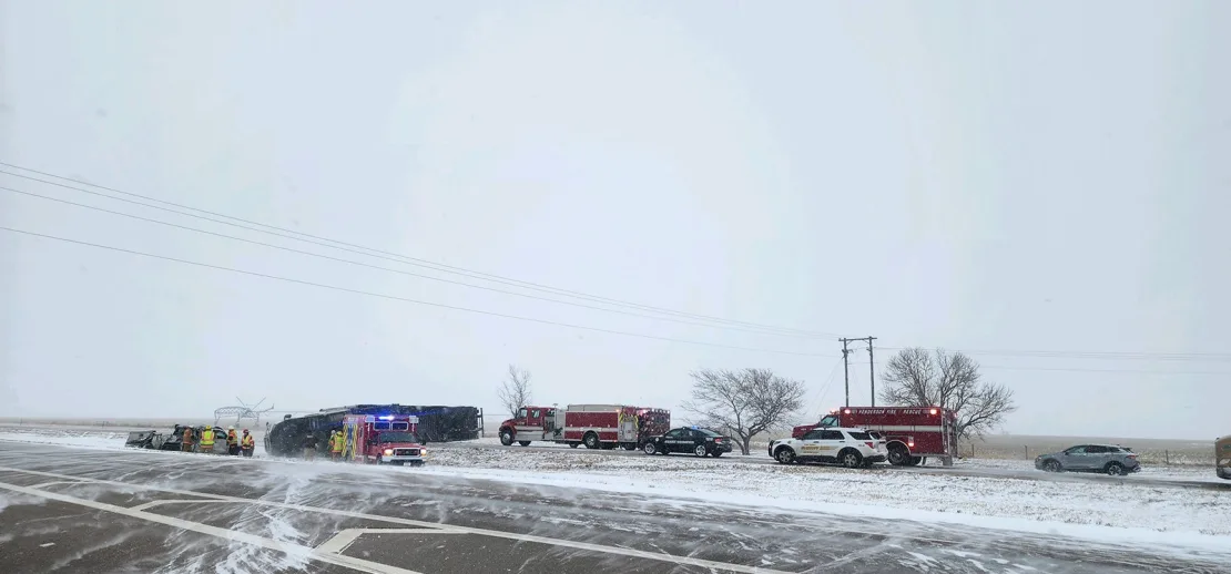
Cars were colliding and sliding off roads Monday in Nebraska, where tractor-trailers jackknifed and got stuck on eastbound Interstate 80 near York in the morning and early afternoon, the Nebraska State Patrol said.
The heaviest snowfall was seen Monday across the border of the Dakotas, stretching north over parts of I-94. While snowfall was beginning to weaken across I-90 on Monday afternoon, visibility was dropping as snow continued to blow over the roadway.
The South Dakota Highway Patrol responded to several crashes in Watertown as ice and snow blanketed roadways.
“Please slow down, don’t use your cruise control, and always wear your seatbelt. Snow plows are out, please give them room to work,” the South Dakota Highway Patrol urged residents.
Snowfall of 1-2 inches per hour was possible in some areas, the weather service said Monday afternoon. More than 12 inches likely will have fallen from south-central South Dakota into northern Nebraska by storm’s end, according to the weather service.
In parts of the northern Plains, a mix of sleet and freezing rain could fuel scattered power outages, and make for dangerously icy roads and sidewalks, forecasters said.
The storm will gradually weaken by Tuesday night, but a “wintry mix is likely to persist into Wednesday” across portions of the northern Plains and upper Midwest, the weather service said.