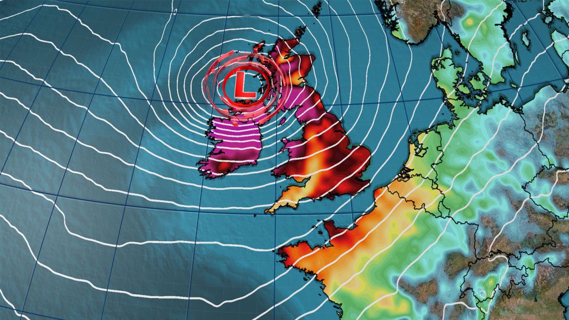
Storm Éowyn, an extratropical “bomb” cyclone that has formed in the North Atlantic and intensified rapidly, is expected to bring gusty winds, heavy rain, and some snow to the region.
Met Éireann, the Irish Meteorological Service, has issued red warnings, its highest alert level, for wind for much of the country beginning early Friday, saying that wind gusts could exceed 80 miles per hour.
The UK’s Meteorological Office, or Met Office, has also placed parts of Northern Ireland under red wind warnings for early Friday for the first time since 2011.
“We reserve the issuing of red warnings for the most severe weather which represents a likely danger to life and severe disruption, and that is the case with Storm Éowyn,” the Met Office’s Chief Meteorologist Paul Gundersen said:
Keith Leonard, the chair of Ireland’s National Emergency Coordination Group, said in a statement that “Storm Éowyn is going to be a very dangerous and destructive weather event.”
All schools in both Ireland and Northern Ireland will be closed on Friday, according to the the Irish Department of Education and the Northern Irish Education Authority. Public transport will not be running in Ireland, according to the authorities.

Nicholas Leach, a postdoctoral weather and climate researcher at Oxford University, told the non-profit Science Media Centre that Éowyn was “likely to cause potentially severe damage,” which he said could include flying debris and fallen trees causing “extremely dangerous driving conditions.”
Along with the wind, Éowyn (pronounced “Ay-oh-win”) is expected to bring rain and snow to parts of the UK. A yellow snowfall warning is in place for parts of northern England and southern Scotland. Across Scotland’s central belt, snowfall could reach somewhere between six to ten inches, according to the Met Office.


